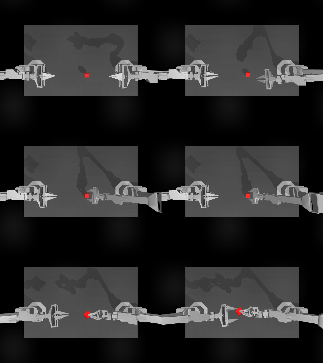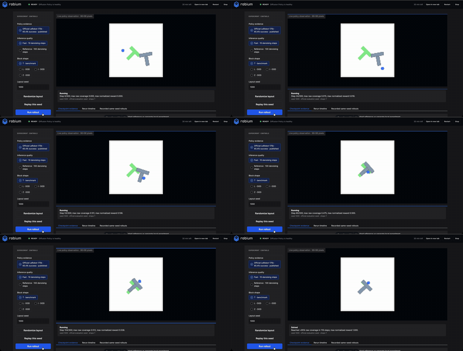
A navigation goal looks like one click in the browser. Behind it, localization has to agree with the map, the planner has to find a route, the controller has to turn that route into velocity commands, and the simulated sensors have to keep the robot out of walls.
This application puts that full loop in one place. A TurtleBot3 Waffle Pi runs in Gazebo, SLAM Toolbox builds the map, AMCL localizes against it, Nav2 drives the robot, and Lichtblick shows the camera, plans, transforms, logs, and application controls.
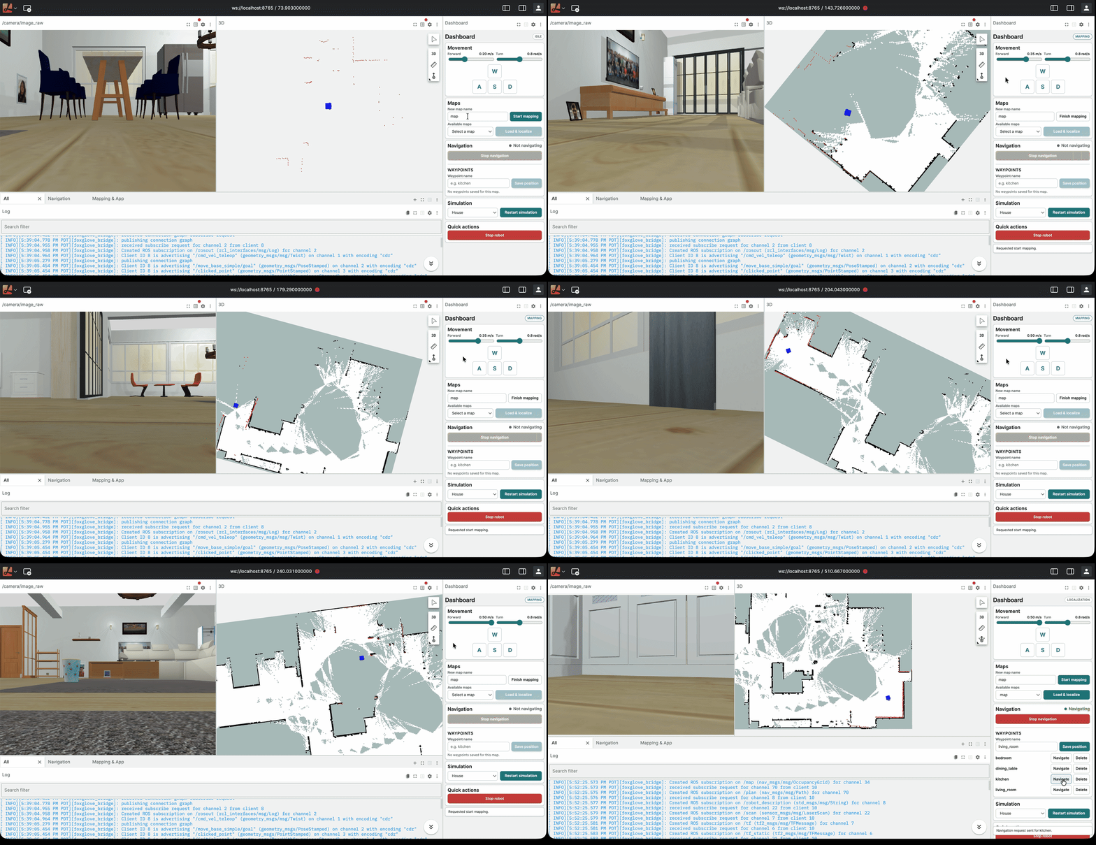
A recorded Gazebo session viewed through Lichtblick. The robot, occupancy map, active plan, camera, and control panel update from the same ROS 2 system.
One loop, two environments
The application includes a simulated house and an industrial warehouse. Both use the same workflow:
- Start the simulation.
- Drive while SLAM builds an occupancy map.
- Save the map and load it for localization.
- Give AMCL an initial pose.
- Send a goal or save the current pose as a waypoint.
- Watch Nav2 plan, control, and report status.
The browser workspace uses
Lichtblick with a committed
layout and the reusable Robium Dashboard extension. The same ROS data is also
available to the official Foxglove application at
ws://localhost:8765.
Lichtblick is the default because it can ship with the application and does not require an account. Foxglove remains useful for teams that want its broader product and support.
How the pieces connect
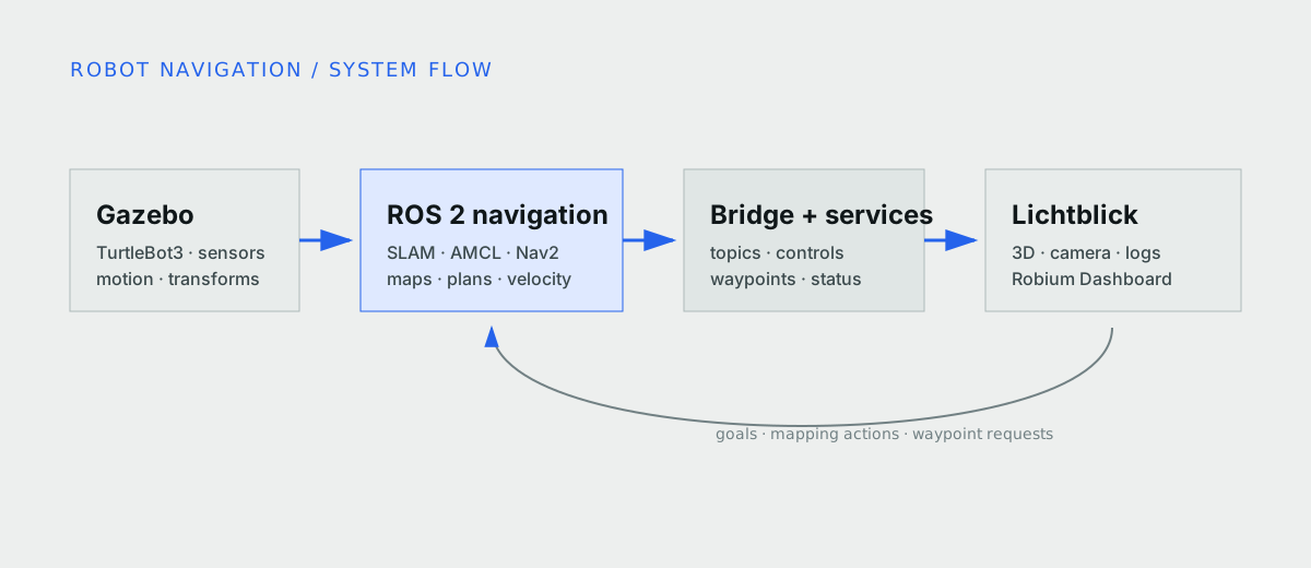
Gazebo publishes the simulated sensors and motion. ROS 2 navigation processes consume that data, then the bridge and application services expose it to the browser.
The main ROS processes share one container and network namespace. On Docker Desktop for macOS, this avoids DDS multicast discovery problems between containers. It also gives local and hosted runs one portable image.
Gazebo publishes lidar, odometry, IMU, camera, and transforms. During mapping,
slam_toolbox turns lidar and odometry into an occupancy map. During
localization, AMCL estimates the robot pose on a saved map. Nav2 plans a route
and publishes velocity commands. foxglove_bridge carries the topics and
services to the browser.
The Dashboard stays separate from the app-specific ROS interfaces. Another project can reuse the extension with fewer controls, different service names, or no simulator section.
Start the stack
You need Git, Docker with Compose v2, a modern browser, and ports 8080 and 8765. The simulation does not require a GPU, physical robot, or system ROS install.
npx robium-ai@latest setup
git clone https://github.com/robium-ai/robium-apps.git
cd robium-apps/robot-navigation
./app doctor
./app run
Open http://localhost:8080. The robot and Gazebo start
in the background, but the application begins in IDLE. Mapping and
localization start only when requested.
The first image build can take about ten minutes. Later runs reuse it unless the source, dependencies, Dashboard, or simulation assets change. The application README covers remote access, remaining commands, and troubleshooting.
Build a map that localization can use
Choose House or Warehouse, enter a map name, and select Start mapping. Drive
with WASD, arrow keys, or the on-screen controls. The lidar scan appears in the
3D view while slam_toolbox expands the occupancy map.
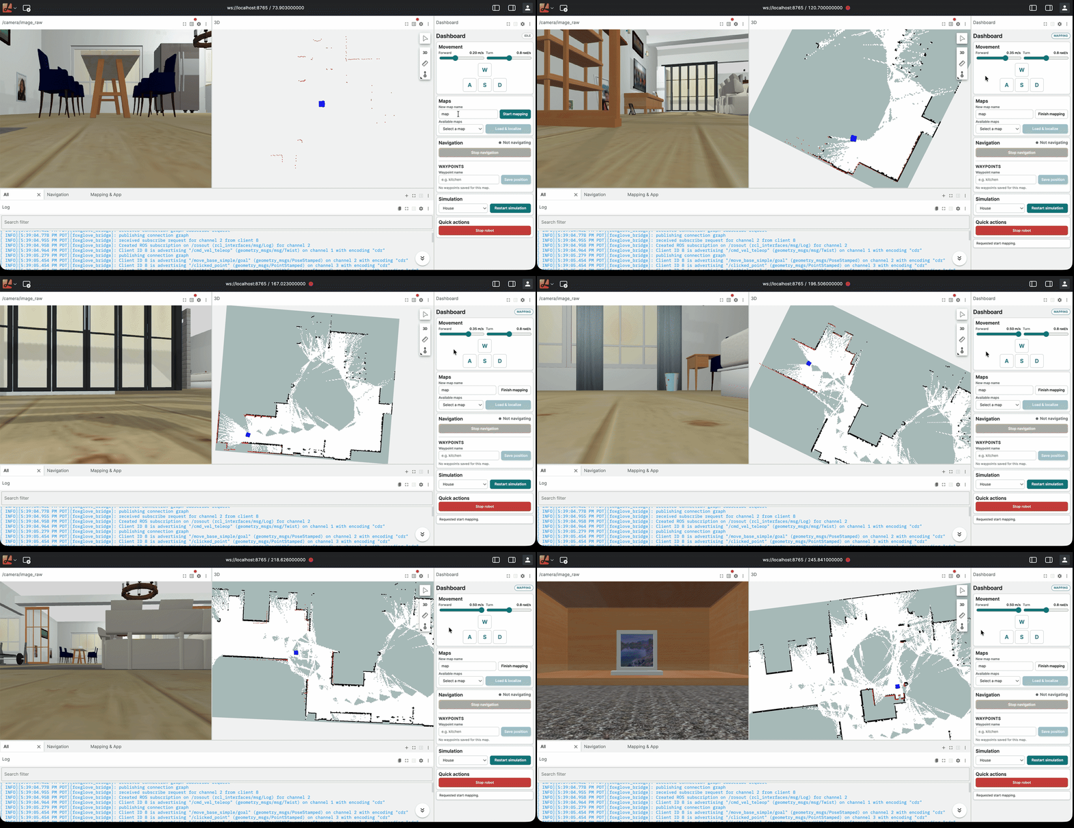
The camera, scan, occupancy map, logs, and Dashboard stay visible during the mapping run.
Observe walls from more than one angle and return near the starting area to close the loop. A quick pass can leave gaps or misaligned walls even when the map looks mostly filled.
Finish mapping saves the files for the active environment and returns the app
to IDLE. Maps and waypoint sidecars remain local and untracked.
Localize before tuning the planner
Load the saved map, then set the robot’s initial pose and heading in the 3D panel. Before sending a goal, check that the map is visible, the scan aligns with nearby walls, and the robot model sits where expected.
If the scan is offset, fix the initial pose first. Planner tuning cannot compensate for a robot localized in the wrong place.
[!DECISION] The workspace keeps localization, plans, and logs visible together because a missing route and a bad pose can look like the same “robot does not move” failure from a control panel alone.
Follow a route and save the destination
Use the 3D goal tool to select a reachable point and heading. Nav2 draws the global plan in cyan. The local controller plan appears in orange and adjusts as the robot moves.
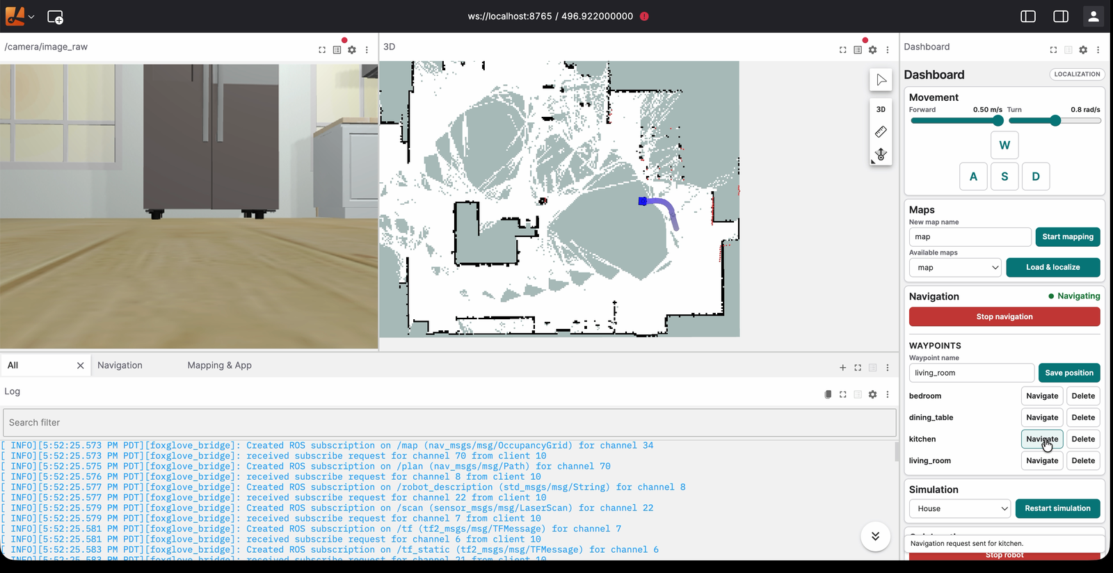
The saved map, localized robot pose, and active global route are visible before the robot starts moving.
A waypoint stores the robot’s current map-frame position and heading. Drive or
navigate to a useful place, give it a name, and select Save position. Waypoints
are stored per map in <map>.waypoints.json, so locations from one environment
do not appear in another.
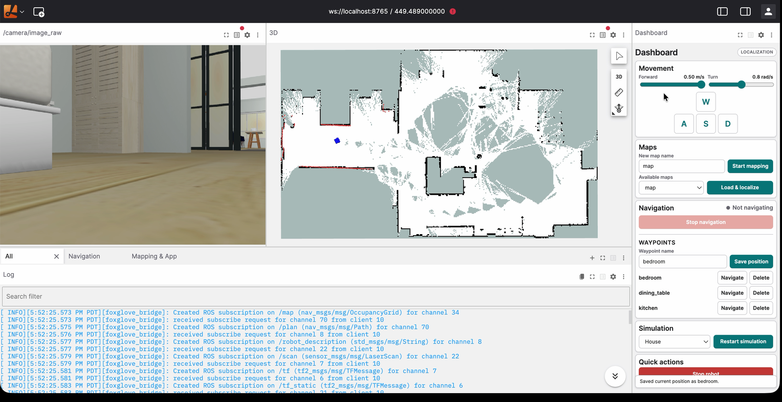
Bedroom, dining table, and kitchen remain attached to the selected house map.
Stop navigation cancels the active Nav2 goal. Stop robot also publishes zero velocity. In this simulated application it is a useful control, not a hardware emergency stop.
Read the visible layers before the logs
The map and plan displays narrow failures quickly:
- No map usually points to the session or map server.
- No global plan points to localization, the goal, or the planner.
- A global plan with no motion points farther down the command path.
- A changing local plan with repeated stops often points to sensors, costmaps, or collision monitoring.
The log panel then filters the shared /rosout stream into all messages,
navigation, and mapping plus application output. A plan only exists after Nav2
receives a goal, so an empty plan display is not automatically an error.
[!EVIDENCE] The recorded sessions cover mapping, map reuse, initial-pose correction, waypoint storage, and multiple navigation goals in Gazebo. They do not cover a physical TurtleBot3.
Debug the path, then keep the lesson
The architect, simulation, and visualization skills kept the first slice
on one inspectable navigation loop. integration and environments shaped the
single-container ROS boundary. ros2, nav2, and foxglove guided the topic,
transform, localization, and browser interfaces.
The repeated lesson was to debug the visible data path before changing parameters. Fixes for browser publishers, velocity message types, map sessions, simulation assets, and waypoint storage were added back to the relevant skills rather than staying as notes inside this app.
Simulation is the boundary
This project covers one simulated TurtleBot3 model with two Gazebo environments. Connecting the same surface to a physical robot needs separate hardware interfaces, networking, safety controls, and calibration. The bundled Lichtblick layout is the primary browser experience; Foxglove can inspect the ROS data but does not receive the same configured Dashboard workflow.
Source, smoke tests, architecture notes, and the reusable Dashboard live in the Robot Navigation application.